The Draa Valley has been continuously inhabited for over 5,000 years and served as the primary trans-Saharan trade corridor between sub-Saharan Africa and the Mediterranean world for at least a thousand years. The valley's kasbahs, seguia irrigation system, and palm grove oases were built and sustained by successive Amazigh clan confederacies whose wealth came from controlling the gold, salt, and ivory trade routes that passed through Zagora.
Introduction
The Draa Valley is one of the oldest continuously inhabited corridors in North Africa. When the Trans-Saharan caravans were at their height — the 11th to 17th centuries — this valley was not the remote desert edge that travellers experience today. It was a commercial artery of global significance: the northern terminus of the gold, salt, and ivory routes from sub-Saharan Africa, the threshold between the Sahara and the Mediterranean world, and the location of some of the wealthiest and most sophisticated communities in the medieval Maghreb.
The kasbahs you see from the N9 road today are not ruins. They are the physical residue of that commercial civilisation — merchant fortresses built to protect wealth accumulated over generations of Trans-Saharan trade. The palm groves they overlook are not natural features; they are the product of a thousand years of engineered irrigation. The seguia channels carrying water through the oasis are older than the oldest kasbah walls. And the families who still live in these communities carry surnames, traditions, and architectural knowledge that connect directly to the medieval period.
This article traces the history of the Draa Valley from its earliest human habitation through the Trans-Saharan trade era, the kasbah-building period, the decline of the trade routes, and the contemporary landscape that visitors encounter at La Petite Kasbah today.
|
✦ KEY TAKEAWAYS |
|
› The Draa Valley has been continuously inhabited for at least 5,000 years — prehistoric rock art in the region predates the pyramids. |
|
› The Trans-Saharan trade routes made the Draa Valley one of the wealthiest corridors in medieval North Africa — gold, salt, slaves, and ivory moved through Zagora for over 600 years. |
|
› The kasbahs were not defensive forts primarily — they were merchant family compounds, built to display and protect wealth accumulated through trade. |
|
› The Jewish community of the Draa Valley (the Mellah) was an integral part of the trade economy — silversmiths, merchants, and money-changers whose presence dated to at least the 11th century. |
|
› The arrival of European sea trade in the 15th century did not destroy the Trans-Saharan routes immediately — the valley remained commercially significant into the 19th century. |
|
TABLE OF CONTENTS |
|
1. Prehistory: The Draa Valley Before History |
|
2. The Berber Peoples: Original Inhabitants of the Valley |
|
3. The Trans-Saharan Trade Routes: When Zagora Faced Timbuktu |
|
4. The Kasbah Era: Architecture of Wealth |
|
5. The Jewish Communities of the Draa Valley |
|
6. Water and Agriculture: The Seguia System |
|
7. The Saadian Dynasty and the Valley's Golden Age |
|
8. Decline and Transformation: The 18th–20th Centuries |
|
9. The Living Heritage: What Remains Today |
|
10. Visiting the History: Where to See It |
Key Periods in the History of the Draa Valley
- Prehistoric settlement (3000 BCE and earlier) — the Draa Valley shows evidence of human occupation dating back at least 5,000 years, with rock art sites in the surrounding Anti-Atlas recording hunter-gatherer and early pastoral communities. The valley's year-round water supply from the Draa River made it a reliable settlement zone long before the agricultural systems that define it today were established.
- Early Amazigh kingdoms (1st millennium BCE–7th century CE) — the Draa Valley was controlled by successive Amazigh confederacies who developed the oasis agricultural system — the three-tier date palm, fruit tree, and ground crop model sustained by the seguia irrigation network. These communities had trading relationships with Carthage and later Rome, supplying gold, ivory, and sub-Saharan produce northward.
- The trans-Saharan trade routes (8th–16th centuries) — the Islamic conquest of the Maghreb in the 7th century transformed the Draa Valley from a regional trading zone into the primary western route of the trans-Saharan trade network. Zagora became one of the most significant staging posts on the route between Timbuktu and Marrakech — the famous sign at the town entrance reading "Timbuktu 52 days by camel" dates from this period.
- The Saadian dynasty (1549–1659) — Morocco's Saadian sultans, themselves originating from the Draa Valley, used the valley's wealth and trade connections as the economic foundation for their empire. The construction of the most elaborate kasbahs in the Draa Valley dates largely from this period, when trans-Saharan gold trade was at its peak and the Saadians controlled both ends of the route.
- The Ait Atta confederation (17th–20th centuries) — the Ait Atta, the dominant Amazigh clan confederation of the southern Draa Valley, controlled the trade routes and maintained the kasbah system through the decline of the Saadian dynasty and into the French protectorate period. Their political and military power is reflected in the scale of the kasbahs at Tamnougalt, Timiderte, and Amezrou.
- French protectorate (1912–1956) — French administration reorganised the valley's governance, built the N9 road connection to Marrakech and Ouarzazate, and shifted the valley's economic orientation away from the trans-Saharan trade (disrupted by the colonial borders that cut across the Saharan routes) toward agriculture and, later, tourism.
- Independence and the modern era (1956–present) — Morocco's independence saw the Draa Valley increasingly connected to the national economy, with irrigation improvements, road development, and the growth of tourism centred on Zagora as a desert gateway. The seguia irrigation system and kasbah architecture continue to function alongside the modern town.
1. Prehistory: The Draa Valley Before History
The Draa Valley's human story begins long before the first written records. Rock engravings found throughout the region — in the Jbel Kissane and at sites along the valley walls — depict elephants, rhinoceroses, giraffes, and cattle, animals that have not existed in this landscape for thousands of years. These engravings date to the Neolithic period and the early Bronze Age, placing human habitation in the valley at a minimum of 5,000 years ago and possibly considerably earlier.
The animals depicted in the rock art tell a story about climate change. The Draa Valley of 5,000–8,000 years ago was not the pre-desert landscape of today. The Sahara was in the midst of the African Humid Period — a climatic phase in which the region received substantially more rainfall, supported extensive grasslands, and hosted megafauna now associated with sub-Saharan Africa. The valley's transition from this green phase to the arid landscape of the present was gradual, unfolding over millennia, and human communities adapted by developing increasingly sophisticated water management systems.
The seguia legacy: the irrigation channels that run through the Amezrou palm grove today are the latest iteration of a water management tradition that began in the valley's prehistoric past — a response to desertification that allowed human communities to remain in a landscape that was slowly becoming inhospitable to rain-fed agriculture.
2. The Berber Peoples: Original Inhabitants of the Valley
The indigenous inhabitants of the Draa Valley are the Amazigh people — known collectively in European languages as Berbers, a term they themselves often reject in favour of Amazigh (meaning 'free people'). The Amazigh are not newcomers to North Africa; genetic and archaeological evidence suggests their ancestors have inhabited the region continuously for at least 12,000 years, making them among the oldest established populations in the world.
In the Draa Valley specifically, the dominant Amazigh groups are the Ait Atta — a confederacy of semi-nomadic and settled clans whose territory historically stretched from the High Atlas to the Sahara. The Ait Atta were both farmers and pastoralists: during summer, they moved their herds into the Atlas highlands; in winter, they returned to the valley. The kasbah architecture of the Draa Valley reflects this dual identity — the fortified structures were built for permanent settlement, but their design accommodates the social organisation of a clan-based society that maintained pastoral connections.
|
◆ Key Aspects of Amazigh Heritage Still Visible in the Draa Valley |
|
◆ Tamazight language: the Amazigh language is still spoken as a first language in many Draa Valley villages — distinct from Arabic, it has its own script (Tifinagh) and a continuous oral tradition of poetry, music, and storytelling |
|
◆ Clan architecture: the layout of traditional ksour (fortified villages) reflects the social structure of the Amazigh clan — common areas, individual family sections, communal granaries, and defensive towers assigned by lineage |
|
◆ Seguia water rights: the traditional water allocation system (managed by the jma'a community council) is a direct continuation of pre-Islamic Amazigh law — modified but not replaced by subsequent Arab and Islamic governance |
|
◆ Weaving traditions: the geometric patterns in Draa Valley carpets and textiles encode clan identity and cosmological symbols that predate Islam — different clans use different motifs, and these patterns have been passed through female lineages for centuries |
|
◆ Oral poetry: the ahwach and ahouach musical traditions of the Draa Valley — communal song and dance performed at weddings, harvests, and festivals — preserve historical memory in a culture where writing was not traditionally the primary medium of record |
3. The Trans-Saharan Trade Routes: When Zagora Faced Timbuktu
The famous sign at the southern edge of Zagora — 'Tombouctou: 52 jours' (Timbuktu: 52 days) — is not a tourist gimmick. It marks the actual historical distance along the Trans-Saharan caravan route from Zagora to Timbuktu in modern-day Mali. For over six centuries, this road was one of the most commercially significant on Earth.
The Trans-Saharan trade system connected the resource-rich kingdoms of sub-Saharan West Africa — the Ghana Empire, the Mali Empire, the Songhai Empire — with the Mediterranean world and beyond. The primary commodities moving north were gold and salt (both of which West Africa had in abundance) and enslaved people (one of the most morally catastrophic aspects of this trade). Moving south were textiles, copper, books, horses, and manufactured goods from the Mediterranean. Zagora and the Draa Valley sat at the northern terminus of the southern routes — the first Moroccan city that caravans reached after crossing the Sahara from M'Hamid.
|
📜 TRANS-SAHARAN TRADE ERA — KEY DATES IN THE DRAA VALLEY |
|
c. 8th century CE Arab conquest of North Africa opens the valley to Islamic trade networks; Draa Valley communities begin integrating into trans-continental commerce |
|
c. 11th century Jewish communities well-established in the Mellah of Amezrou and other valley towns — working as silversmiths, money-changers, and merchants in the caravan economy |
|
c. 13th century Zawiya Naciria founded at Tamegroute — becomes a major centre of Islamic scholarship and manuscript production, drawing scholars from across North Africa |
|
1324 Mansa Musa of the Mali Empire passes through or near the region on his legendary hajj to Mecca — his caravan of 60,000 people and 12 tonnes of gold is the most spectacular display of West African wealth in medieval history |
|
15th–16th century The kasbah-building era reaches its peak — the great merchant families construct the fortified compounds that still define the Draa Valley landscape |
|
1591 The Saadian Sultan Ahmad al-Mansur sends an army across the Sahara to conquer the Songhai Empire — the Draa Valley is the departure point, and the expedition changes the political economy of the entire region |
|
17th–18th century Gradual decline of Trans-Saharan trade as European sea routes to West Africa increasingly bypass the overland routes |
|
1956 Moroccan independence; the Jewish community of the Draa Valley emigrates largely to Israel over the following decade |
|
1980s–present Tourism development begins; the Draa Valley is rediscovered by travellers — La Petite Kasbah established in the Amezrou palm grove |
4. The Kasbah Era: Architecture of Wealth
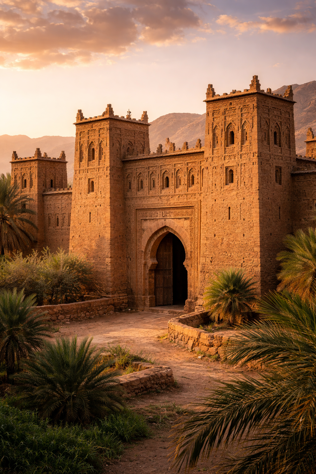
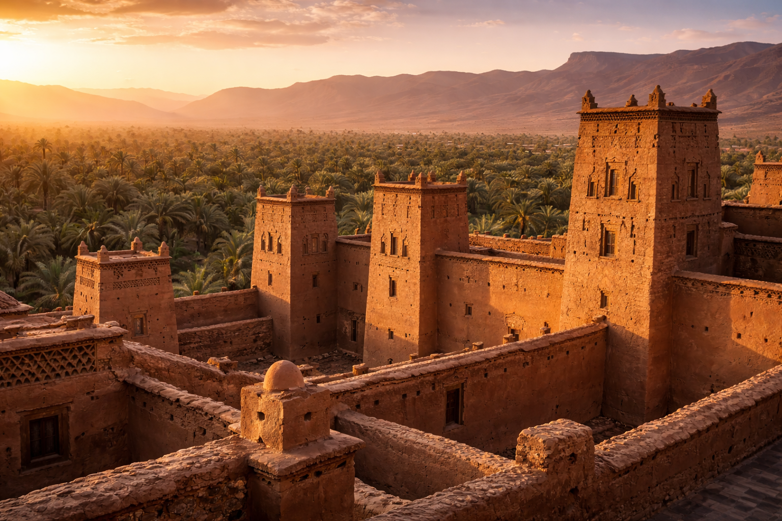
The kasbahs of the Draa Valley are the most visible legacy of the Trans-Saharan trade era. Understanding what they are — and what they are not — is essential to reading the landscape correctly.
A kasbah (from the Arabic qasba) in the Draa Valley context is a fortified residential compound: a large family dwelling built in pisé (rammed earth) with defensive towers at the corners and a single heavily reinforced gate. They were not primarily military installations — Moroccan history produced dedicated fortresses (ribats) and citadels for that purpose. The Draa Valley kasbahs were merchant homes. The towers were not for archers; they were for displaying the family's wealth and status. The thickness of the walls was not primarily for defence; it was for thermal regulation in a desert climate. The elaborateness of the geometric decorations above doorways and windows was not religious expression; it was conspicuous expenditure — the architectural equivalent of a luxury car.
|
◆ Reading a Draa Valley Kasbah: What Each Element Means |
|
◆ Corner towers: the height and number of towers signal the family's status — the tallest and most elaborate towers belonged to the wealthiest clans |
|
◆ Decorative geometric patterns: pressed into the wet pisé before it dried, each pattern is specific to a family or village lineage — no two kasbahs have identical decoration |
|
◆ The single gate: a security feature, yes — but also a statement of controlled access. The kasbah gate was where commercial transactions were initiated and where the family's hospitality was dispensed |
|
◆ Interior layout: a kasbah compounds multiple family units around a central courtyard — the organisation reflects the clan structure of Amazigh society, with senior family members occupying the most favourable rooms |
|
◆ The granary: every kasbah contains grain storage — the management of food reserves was as important as the management of trade goods. Families who controlled grain could survive droughts that displaced less organised communities |
|
◆ Pisé construction: rammed earth mixed with straw and water, dried in the sun — labour-intensive to build, requiring the whole community, and maintained annually against rain erosion. The collective maintenance of kasbah walls was a social activity that reinforced community bonds |
The greatest concentration of kasbahs in the Draa Valley occurs between Agdz and Zagora — the 100-kilometre section of the valley that corresponds to the most productive agricultural land and the most significant caravan staging points. The kasbahs at Tamnougalt (near Agdz), Timiderte, and Amezrou (surrounding La Petite Kasbah in Zagora) are among the finest surviving examples of this tradition.
5. The Jewish Communities of the Draa Valley
The presence of Jewish communities in the Draa Valley is one of the most historically significant and least widely known aspects of the region's heritage. Jewish settlement in Morocco dates to antiquity — some traditions claim it preceded the destruction of the First Temple in 586 BCE, making the Moroccan Jewish community potentially one of the oldest in the diaspora.
In the Draa Valley specifically, Jewish communities are documented from at least the 11th century, though oral traditions and some historical sources suggest considerably earlier settlement. These communities occupied a specific niche in the regional economy: they worked primarily as silversmiths (crafting the jewellery and decorative metalwork that was a standard currency of the caravan trade), as money-changers (essential for a trade economy dealing in multiple currencies across vast distances), and as long-distance merchants.
The architectural legacy of the Jewish community is still visible throughout the valley — most notably in the Mellah of Amezrou, directly surrounding La Petite Kasbah. The Mellah (the term derives from the Arabic for salt, and may reflect the early Jewish role in the salt trade) is a distinct neighbourhood within the village, its houses built in the same earthen style as the surrounding Berber architecture but distinguished by carved Stars of David above the doorways.
The departure: between 1956 and the late 1960s, the Jewish community of the Draa Valley emigrated almost entirely — first to Casablanca, then predominantly to Israel, with smaller numbers going to France and Canada. The houses passed to Berber families. The Stars of David above the doorways were not removed — in the Draa Valley, they were regarded as protective symbols that transcended religious identity. The synagogue in Amezrou has been restored and is open to visitors.
6. Water and Agriculture: The Seguia System
The oasis agriculture of the Draa Valley — which has sustained human settlement in this desert-edge environment for over a thousand years — rests on a single technological foundation: the seguia. These shallow earthen irrigation channels distribute water from the Draa River to individual date palm estates throughout the valley, operating according to a traditional allocation system that predates Islamic law and has been modified but never replaced by subsequent governance.
The seguia system works on the principle of time-shares. The flow of the Draa River at a given point is divided into a fixed number of shares (nauba), each assigned to a specific family or community. On their allocated day and hour, families divert the channel flow into their section of the grove. The timing and sequence of these allocations are managed by the jma'a — the community council — using a traditional calendar that accounts for seasonal variation in river flow.
Why this matters for visitors: when you walk through the Amezrou palm grove and see water running in a seguia channel, you are watching a water management system that has been operating continuously for at least a thousand years. The specific channels have been rebuilt and rerouted; the allocation agreements have been renegotiated; but the underlying technology and social organisation are direct continuations of medieval and pre-Islamic practice. This is not a heritage reconstruction — it is the actual thing.
7. The Saadian Dynasty and the Valley's Golden Age
The 16th century represents the apex of the Draa Valley's historical significance. Under the Saadian dynasty — Moroccan sultans who rose to power in the 16th century with the Draa Valley and the Souss region as their base — the valley became not just a trade conduit but a political centre of the first importance.
The defining moment came in 1591, when the Saadian Sultan Ahmad al-Mansur — known as al-Dhahabi (the Golden) for the wealth he accumulated from Trans-Saharan trade — dispatched an army of approximately 4,000 soldiers across the Sahara to conquer the Songhai Empire and seize control of the Timbuktu gold trade at its source. The army crossed the desert from M'Hamid at the southern end of the Draa Valley, completing the crossing in approximately 135 days under conditions of extraordinary hardship. They defeated the Songhai at the Battle of Tondibi in March 1591.
The consequences for the Draa Valley were complex. In the short term, al-Mansur's gold windfall made his court at Marrakech one of the wealthiest in the world and increased trade through the valley. In the longer term, the Moroccan occupation of Timbuktu disrupted rather than enhanced the trade network — the Songhai Empire disintegrated, the ordered caravan economy became more dangerous and unpredictable, and the long decline of Trans-Saharan trade began.
8. Decline and Transformation: The 18th–20th Centuries
The decline of the Draa Valley's commercial significance was gradual, operating over two centuries and driven by multiple overlapping forces. The most important was the development of European sea routes to West Africa — Portuguese and later Dutch and British trading ships that could move West African gold directly to Europe without passing through North Africa at all. By the 18th century, the Trans-Saharan routes had lost their dominant position in the global gold trade, though they continued to operate for other commodities.
The valley's population did not collapse with the trade routes. The agricultural economy — the date palms, the grain fields, the olive groves — continued to support the existing communities. But the great kasbah-building era was over. The wealth that had funded the construction of the elaborate merchant compounds was no longer being generated. Without the economic surplus from trade, the kasbahs that required annual maintenance began a slow process of erosion and partial abandonment that continues today.
The French Protectorate period (1912–1956) brought administrative integration with a broader Moroccan and North African economy but also accelerated some traditional practices' decline. The road network that made the N9 drive possible today was largely constructed during this period. The Protectorate ended with Moroccan independence in 1956 — the same year that began the departure of the Jewish community.
9. The Living Heritage: What Remains Today
The Draa Valley today is not a historical theme park. It is a living landscape where the past is present in material form — in the kasbah walls, the seguia channels, the Mellah doorways, the manuscript library at Tamegroute, the clan-based community organisation, the Tamazight language spoken in the villages. What has changed is the economic basis of the community — from trade to agriculture to, now, a growing tourism economy.
|
◆ Where the History Is Still Visible and Accessible |
|
◆ The Amezrou Mellah (Zagora): the historic Jewish quarter surrounding La Petite Kasbah — Star of David lintels, restored synagogue, earthen architecture unchanged from the medieval period |
|
◆ The Tamegroute Library: the Zawiya Naciria manuscript collection — 13th-century Islamic texts on gazelle skin and parchment, one of the most important manuscript libraries in North Africa, 45km south of Zagora |
|
◆ The Tamnougalt Kasbah (Agdz): one of the finest surviving medieval kasbahs in the valley — partially inhabited, partially open to visitors, the clearest example of the merchant compound typology |
|
◆ The seguia network (Amezrou palm grove): the living irrigation system — walk the channels from La Petite Kasbah and watch the medieval water allocation system in active operation |
|
◆ The 'Timbuktu: 52 days' sign (Zagora town): the most direct historical marker in the valley — the physical remnant of the caravan road that defined the valley for six centuries |
|
◆ The N9 road between Agdz and Zagora: every kasbah visible from this road is a physical record of the Trans-Saharan trade era — the density and scale of the architecture tells the story of the wealth that passed through this valley |
10. Visiting the History: Where to See It
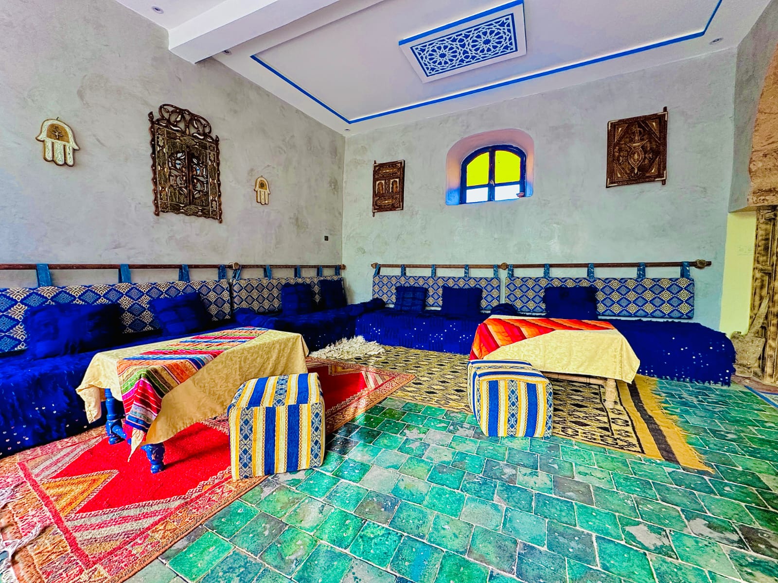
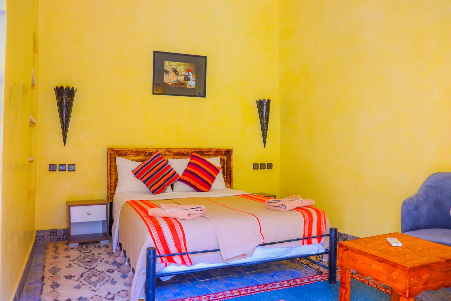
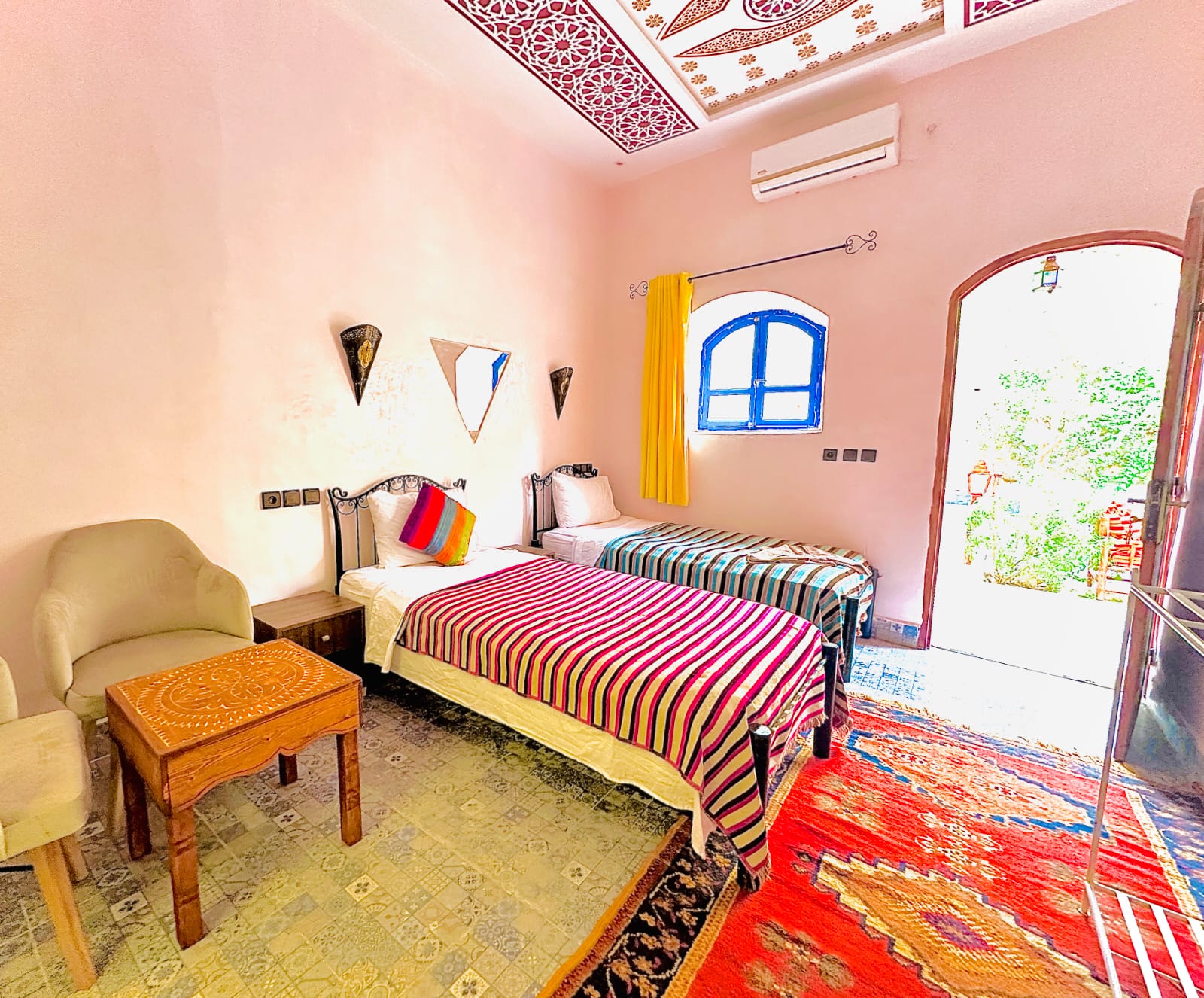
La Petite Kasbah in the Amezrou palm grove is the ideal base for exploring the Draa Valley's history. The riad sits within the historic Mellah, within walking distance of the surviving Jewish quarter and synagogue, at the edge of the seguia network, and at the centre of the kasbah landscape that extends along the N9 in both directions.
-
From the riad door: Walk north into the Amezrou Mellah — 10 minutes. The Star of David doorways, the synagogue, the earthen architecture unchanged for centuries.
-
30 minutes by car (north): Tamnougalt Kasbah near Agdz — one of the finest medieval kasbahs in the valley, accessible and partially open.
-
45 minutes by car (south): Tamegroute — the manuscript library of the Zawiya Naciria and the green pottery workshop. One of the most culturally significant sites in southern Morocco.
-
The N9 itself: Drive north from Zagora toward Agdz at late afternoon. Every kasbah you see from the road is a merchant family compound from the trade era — the landscape reads as history if you know what you are looking at.
-
The 'Timbuktu: 52 days' sign: At the southern edge of Zagora town — 15 minutes by bicycle from La Petite Kasbah. The most emotionally resonant historical marker in the valley.
|
✔ |
The Draa Valley has been continuously inhabited for at least 5,000 years — one of the oldest settled corridors in North Africa |
|
✔ |
The Trans-Saharan trade routes (8th–17th centuries) made the valley one of the wealthiest in the medieval Maghreb |
|
✔ |
The kasbahs were merchant family compounds — built to display and protect wealth from the caravan trade, not primarily military forts |
|
✔ |
The Jewish community of the Draa Valley (Mellah) was integral to the trade economy — their architectural legacy surrounds La Petite Kasbah |
|
✔ |
The seguia irrigation system is over 1,000 years old and still in active use — visible and walkable from La Petite Kasbah |
|
✔ |
Tamegroute (45km south) holds one of North Africa's most important Islamic manuscript libraries — founded in the 13th century |
|
✔ |
La Petite Kasbah sits within the historic Amezrou Mellah — the ideal base for experiencing this history in situ |
Frequently Asked Questions
What is the history of the Draa Valley?
The Draa Valley has been continuously inhabited for over 5,000 years and served as the primary trans-Saharan trade route between sub-Saharan Africa and Morocco for at least a thousand years. The valley's wealth came from controlling the gold, salt, and ivory trade. Its kasbahs were built by Amazigh clan confederacies — particularly the Saadians and Ait Atta — at the peak of this trade in the 16th to 18th centuries.
How old is the Draa Valley?
The Draa Valley shows evidence of human habitation dating back at least 5,000 years — rock art in the surrounding Anti-Atlas records prehistoric communities from this period. The seguia irrigation system that sustains the palm groves dates to at least the 11th century. The kasbahs visible along the N9 were built primarily during the 16th to 18th centuries at the height of trans-Saharan trade wealth.
What was the trans-Saharan trade route through the Draa Valley?
The Draa Valley formed the western arm of the trans-Saharan trade network — the route along which gold, salt, ivory, and slaves moved north from sub-Saharan Africa to Morocco and the Mediterranean, and cloth, spices, and manufactured goods moved south in return. Zagora was one of the most significant staging posts on this route. The trade made the Draa Valley kasbahs possible — their scale reflects the wealth it generated.
What are the kasbahs of the Draa Valley?
The kasbahs of the Draa Valley are fortified earthen family compounds built in pisé by the Amazigh clan confederacies who controlled the trans-Saharan trade routes. The geometric pressed patterns on tower surfaces are clan identifiers specific to each family lineage. The finest surviving examples are at Tamnougalt, Timiderte, and Aït Ben Haddou — built primarily during the 16th to 18th centuries.
Who built the kasbahs in Morocco?
The kasbahs of the Draa Valley were built by Amazigh clan confederacies — primarily the Ait Atta in the south — using wealth from controlling the trans-Saharan trade routes. Each kasbah was built by a single family as both fortified residence and status statement. The construction technique — pisé rammed earth — has been used continuously in the valley for over a thousand years.
What is the significance of Zagora in Moroccan history?
Zagora was one of the most strategically important towns on the western trans-Saharan trade route — the last significant settlement before the desert began and the first after the long crossing from Timbuktu. The sign at the town entrance reading "Timbuktu 52 days by camel" marks this heritage directly. The Alaouite dynasty, which rules Morocco today, traces its origins to the Draa Valley region near Zagora.
What is the Draa River?
The Draa River is Morocco's longest river — approximately 1,100km from its High Atlas source to the Atlantic coast. Through the Draa Valley, it flows strongly after Atlas snowmelt in spring and runs dry or subsurface in summer. The oasis palm groves are sustained not by the river directly but by the seguia irrigation channels drawn from it — a managed system over a thousand years old.
What wildlife can you see in the Draa Valley?
The Draa Valley supports a range of wildlife adapted to the desert-edge oasis environment. Birds include Moussier's redstart, the blue-cheeked bee-eater, Barbary falcon, desert sparrow, and numerous migrating species using the palm grove as a waypoint. Fennec foxes and desert hedgehogs are nocturnal and occasionally seen near the dunes. Desert monitor lizards are common on the warm stone walls of kasbahs. The seguia channels support small fish, frogs, and dragonflies — indicators of the oasis water system's health.
What to see in the Draa Valley?
The essential sights of the Draa Valley are: the kasbahs at Tamnougalt and Timiderte, the 100km palm grove corridor between Agdz and Zagora, the Amezrou Mellah in Zagora, the Wednesday and Sunday souk, the Tamegroute Koranic library and pottery workshops, the Tinfou dunes 25km south of Zagora, and the Jebel Zagora summit viewpoint over the entire valley and desert beyond.
What is the Amazigh and Jewish history of the Draa Valley?
The Draa Valley has two ancient communities whose histories are intertwined with the trans-Saharan trade. The Amazigh (Berber) population built the kasbah system and developed the seguia irrigation network over more than a thousand years. The Jewish community — present in the Draa Valley since at least the 2nd century CE, and possibly earlier — controlled significant portions of the caravan trade, particularly in gold and silver. The Mellah of Amezrou, surrounding La Petite Kasbah, was the Jewish quarter of the oasis community. Its Star of David lintels and the ruins of the synagogue are still visible today. Most of the Draa Valley's Jewish community emigrated to Israel between 1948 and 1967.
What are the best-preserved ksour and kasbahs in the Draa Valley?
The finest surviving examples are Tamnougalt — 10km south of Agdz, one of the oldest and most complete ksour in the valley with inhabited sections still maintained in traditional pisé; Timiderte — visible from the N9, its towers photographically exceptional in late afternoon light; Aït Ben Haddou — 9km off the N9 near Ouarzazate, UNESCO World Heritage Site and the most internationally recognised ksar in Morocco; and the Amezrou kasbah complex in Zagora, which includes the Mellah and the La Petite Kasbah building.
How have historical trade routes shaped the Draa Valley?
The trans-Saharan trade route shaped every visible element of the Draa Valley. The kasbahs were built with trade wealth — their scale reflects the economic importance of controlling the route at its peak in the 16th to 18th centuries. The palm grove oases were expanded to sustain the caravans passing through. The souk tradition in Zagora originates in the staging-post function of the town. Even the seguia irrigation system was developed partly to sustain a permanent population large enough to service the trade. When the French colonial borders disrupted the trans-Saharan routes in the early 20th century, the valley's economy contracted significantly — the decline in kasbah maintenance that began then is still visible today.
What historical Moroccan dynasties ruled the Draa Valley?
The Draa Valley passed through the control of several major Moroccan dynasties. The Almoravids (11th century) consolidated Islamic control of the valley and the trans-Saharan routes. The Almohads (12th–13th centuries) maintained this control. The Saadians (16th–17th centuries) — originating from the Draa Valley themselves — made the valley the economic foundation of their empire, funding the construction of Marrakech's El Badi Palace with Draa Valley trans-Saharan gold. The Alaouites, who have ruled Morocco since the 17th century and trace their origins to the Draa Valley region, maintain a historical connection to the valley that continues to the present dynasty.
What are the must-see ancient kasbahs and fortified villages in the Draa Valley?
The three essential stops are Tamnougalt (10km south of Agdz), Timiderte (visible from the N9 between Agdz and Zagora), and the Amezrou complex in Zagora. For travellers with more time, the ksar at Aït Ben Haddou near Ouarzazate is the finest preserved example in southern Morocco. The Draa Valley Road Trip article on hotelzagora.com gives specific timing and access information for each site.
What are the popular hiking routes in the Draa Valley?
The most accessible hike from Zagora is Jebel Zagora — the flat-topped mountain south of town, a 2–3 hour return hike with panoramic views over the palm grove, valley, and desert. The Amezrou palm grove seguia walk is a flat 90-minute circuit from La Petite Kasbah through the irrigation channels and Mellah. Longer trekking routes connect the valley kasbahs between Agdz and Zagora and require a local guide.
What was the historical significance of the Draa Valley as a trans-Saharan trade route?
The Draa Valley was the western axis of the trans-Saharan trade network for approximately 800 years — from the Islamisation of the Maghreb in the 8th century to the disruption of the routes by colonial borders in the early 20th century. At its peak in the 16th century, an estimated 12,000 camels per year passed through Zagora carrying gold, salt, ivory, and enslaved people northward, and cloth, spices, horses, and weapons southward. This volume of trade made the Draa Valley one of the wealthiest corridors in the pre-modern world, and the kasbahs it funded are the most visible legacy of that wealth today.
What is the significance of the Timbuktu sign in Zagora?
The sign at the entrance to Zagora reading "Timbuktu 52 days by camel" marks the town's historical position on the western trans-Saharan trade route — the route along which gold, salt, and ivory moved north from sub-Saharan Africa to Morocco and the Mediterranean world. At the height of the trade in the 16th century, Zagora was the last significant staging post before the desert crossing south. The sign is not a tourist installation — it is a historical marker of genuine significance, and 52 days by camel is an accurate estimate of the journey time across the Sahara to Timbuktu in Mali.
|
Experience the Draa Valley's History from La Petite Kasbah Rated 9.3/10. Situated within the historic Amezrou Mellah. The Tamegroute library, Tamnougalt kasbah, seguia network, and the 'Timbuktu: 52 days' sign — all within reach. |